

Alonso Vélez de Mendoza's Expedition to Brazil
In this entry · 16 sections
Expedition · 1500. Alonso Vélez de Mendoza.
Diego Fernández’s edition distinguishes the July 1500 capitulation and obligations added in August. León Guerrero describes two effective caravels, Santi Spiritu and San Cristóbal, against four authorised vessels. [B183]¶ [B141]
González Ochoa gives late August from Sanlúcar and about 20° S; León Guerrero, early September from Seville and an extent to 23–24° S. The latter reconstructs a return in early June 1501 from testimony and later cartography. The latitudes are interpretations, not a preserved daily position log. [B283] [B141] [B141]
Context
The discovery licenses of 1500 drove voyages financed by private individuals. [B183]
Stages
Development
The enterprise reached the Brazilian coast and surveyed sectors south of the initial routes. [B141]
Route data
- Enterprise of Alonso Vélez de Mendoza with members of the Guerra family.
- He surveyed sectors south of the routes of Pinzón and Lepe.
- Number of ships not specified in the sources consulted.
Outcome
León Guerrero places return in early June 1501 and notes that the reports to be delivered to Fonseca have not survived. [B141]
Limits of the evidence
The date of the capitulation is not turned into a sailing day, and no specific port is fixed without sufficient documentation. [B183]
Expedition facts
| Date | 1500 |
|---|---|
| Leader | Alonso Vélez de Mendoza |
| Departure | Andalusian coast |
| Destination | Brazil |
| Period | 1500 |
Organisation
González Ochoa dates departure from Sanlúcar to late August; León Guerrero gives Seville in early September 1500. The authorised preparation of four vessels is distinguished from the two described in the voyage reconstruction. [B141] [B283]
Objectives
- Voyage of reconnaissance of the Atlantic coasts of South America. [B141]
Recorded vessels
- Santi Spiritu, with Luis Guerra, and San Cristóbal, with Alonso Vélez, according to León Guerrero. [B141]
People and societies
- Alonso Vélez de Mendoza: Captain of San Cristóbal, according to León Guerrero [B141]
Related people
Related cartography
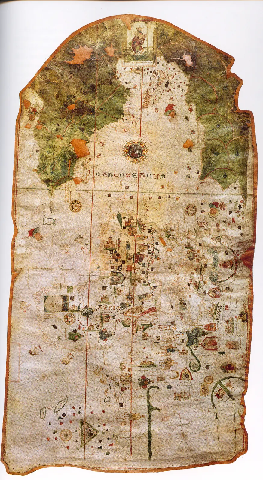
Juan de la Cosa's chart · 1500. It is not a map of the route of Columbus's first voyage. The image reproduces the chart preserved in the Naval Museum, MNM 257.
Sources and references
- [B20] Colección de los viages y descubrimientos que hicieron por mar los españoles desde fines del siglo XV, tomo III. Martín Fernández de Navarrete. Madrid, Imprenta Real, 1829. Original record
- [B183] Capitulaciones colombinas (1492–1506). Rafael Diego Fernández. 1987. Original record
- [B141] The Andalusian voyages (1498–1503). Andalucía en la Historia 75. David González Cruz (dossier coordinator) and various authors. April 2022. Original record
- [B283] Alonso Vélez de Mendoza. José María González Ochoa. Undated electronic edition; consulted on 2 November 2026. Original record
- Collection of voyages and discoveries, volume III. Martín Fernández de Navarrete, edition of documents and accounts (1829). Accounts and documents on the minor voyages. The date of a capitulation must be distinguished from the departure, and the editor's reconstructions checked.
General bibliography guides further reading; it is not a pinpoint reference for every claim. Page, chapter and archival references are identified at the relevant passages.
Further reading and comparison
- Columbus's fall as governor · 1500
- Diego de Lepe's Expedition to Brazil · 1500
- Cristóbal Guerra's Second Voyage to the Mainland · 1500
- Vélez de Mendoza's Settlement Expedition · 1502
Examine and compare documents
- Vélez de Mendoza: licence and settlement — Does a capitulation establish what actually sailed? ·
Documentary supplements with their own review scope; they do not certify a complete collation of this entry.
Send comments to the author
Found an error or have information to contribute? Write privately to the author.