

Diego de Lepe's Expedition to Brazil
In this entry · 15 sections
Expedition · 1500. Diego de Lepe.
González Hernández describes two caravels and funding by Lepe and Francisco Vélez, with experienced pilots. She records departure discrepancies and does not establish an exact southern latitude for the Brazilian landing. [B279] [B279]
Her reconstruction follows the coast towards Paria, placing exchange, conflict and the meeting with Pinzón there. She dates return to Seville to mid-August 1500 and relates the reports to Juan de la Cosa’s chart. Modern identifications are attributed to that study. [B279] [B279]
Context
Private voyages sought to extend knowledge of the South American coasts. [B279]
Stages
- Late 1499–early 1500, Palos de la Frontera: Departure with disputed chronology; the study does not establish a precise quay at Palos. [B279]
Development
Lepe covered sectors of Brazil and returned to the Peninsula; the identification of capes and river mouths is disputed. [B279] [B279]
Route data
- 2 ships according to reconstructions.
- He followed and extended Pinzón's route; the two were neighbors in Palos.
- The identification of capes and river mouths remains disputed.
Outcome
His reports broadened European knowledge of the South American Atlantic coast. [B279]
Limits of the evidence
The exact departure date and the identification of some places are unresolved. The old key is kept without creating a duplicate voyage. [B279]
Expedition facts
| Date | 1500 |
|---|---|
| Leader | Diego de Lepe |
| Departure | Palos de la Frontera |
| Destination | Brazil |
| Period | Late 1499–early 1500 |
Organisation
González Hernández mentions the Tinto-Odiel estuary and a passage to sea via Sanlúcar. She records differing dates between November and December 1499 and early 1500, questioning the latter. No particular quay is identified. [B279]
Objectives
- Survey of the Brazilian coast, close to the voyage of Vicente Yáñez Pinzón. [B279]
Recorded vessels
- Two caravels according to González Hernández; financing is attributed to Lepe for one and Francisco Vélez for the other. [B279]
People and societies
- Diego de Lepe: Organiser of the venture, relying on experienced pilots [B279]
Related people
Related cartography
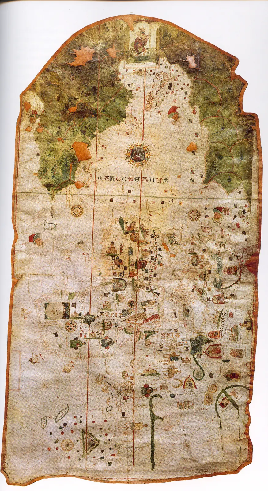
Juan de la Cosa's chart · 1500. It is not a map of the route of Columbus's first voyage. The image reproduces the chart preserved in the Naval Museum, MNM 257.
Sources and references
- [B146] Pinzón and the Hispanic roots of Brazil. Mariano Cuesta Domingo. Revista de Historia Militar, 116 (2014), pp. 103–154. Original record
- [B20] Colección de los viages y descubrimientos que hicieron por mar los españoles desde fines del siglo XV, tomo III. Martín Fernández de Navarrete. Madrid, Imprenta Real, 1829. Original record
- [B69] Juan de la Cosa's chart. Juan de la Cosa. 1500; MNM 257. Original record
- [B1] General and Natural History of the Indies: second part, first volume. Gonzalo Fernández de Oviedo; edition by José Amador de los Ríos. Work of the 16th century; linked volume edited in 1852. Original record
- [B5] De Orbe Novo, volumen 1. Pedro Mártir de Anglería; traducción de Francis A. MacNutt. Decades written from 1493; translation of 1912. Original record
- [B279] Diego de Lepe. Cristina González Hernández. Undated electronic edition; consulted on 2 November 2026. Original record
- Pinzón and the Hispanic roots of Brazil. Ministry of Defense, Revista de Historia Militar 116. Study discussing cartography, documentation and the location of the first landfall.
- Collection of voyages and discoveries, volume III. Martín Fernández de Navarrete, edition of documents and accounts (1829). Accounts and documents on the minor voyages. The date of a capitulation must be distinguished from the departure, and the editor's reconstructions checked.
Documents and call numbers
- PATRONATO,29,R.5 · Account of Lepe's voyage
General bibliography guides further reading; it is not a pinpoint reference for every claim. Page, chapter and archival references are identified at the relevant passages.
Send comments to the author
Found an error or have information to contribute? Write privately to the author.