

Fourth Voyage of Christopher Columbus
In this entry · 21 sections
- Context
- Stages
- Events of this expedition
- Route data
- Outcome
- Limits of the evidence
- Expedition facts
- Organisation
- Objectives
- Encounters and societies
- Recorded vessels
- People and societies
- Related people
- Related cartography
- Art and memory
- Other expeditions with shared protagonists
- Mentioned in other entries
- Sources and references
- Further reading and comparison
- Examine and compare documents
- Sources of the related expeditions
Expedition · 1502. Cristóbal Colón.
In May 1502 Columbus leaves Cádiz with four ships on his fourth and last voyage. He has lost the government of Hispaniola, but keeps the hope of finding a sea passage to Asia, which by his calculations must lie west of the lands already known. With him travel his son Ferdinand and his brother Bartholomew. [B8]
Ovando refuses Columbus’s request for shelter at Santo Domingo as a hurricane approaches. The expedition then explores the coasts of Honduras, Nicaragua, Costa Rica and Panama. Winds, weather and Indigenous resistance hamper navigation; it does not find the sea passage sought. [B8]
Columbus’s letter describes the settlement at Veragua and the capture of Quibian and his family; Las Casas recounts the trading canoe at Guanaja and detention of an informant. The narrator of each episode is identified. [B9]¶ [B16]
The last two ships were stranded at Jamaica. Méndez recounts his provisioning agreements and canoe journey to Hispaniola to obtain assistance. Pérez de Tudela dates departure from Jamaica to 28 June 1504 and return to Sanlúcar to 7 November. [B9]¶ [B9]¶ [B8]
Context
After losing effective government of Hispaniola, Columbus undertook another campaign to reach Asia. The Castilian presence in the Caribbean coexisted with Indigenous territories and routes that it did not control. [B8] [B8]
Stages
- May 1502, Peninsula and Canary Islands: Departure of the last Columbian voyage. [B8]
- 1502, Guanaja and Honduras: Contacts and survey of Central American coasts. [B16]
- 1502–1503, Central American Caribbean coast: Search for a passage and attempt at settlement in Veragua. [B8] [B9]
- 1503–1504, Jamaica: The vessels were rendered unusable; the expedition waited for relief. [B8]
- 1504, Hispaniola: Rescue and preparation of the return. [B8]
- November 1504, Sanlúcar: Return to the Peninsula. [B8]
Events of this expedition
Route data
- 4 ships and about 140 men, among them Bartholomew Columbus and Ferdinand Columbus, aged 13.
- Columbus sought a maritime passage to Asia on the coast of Central America.
- Diego Méndez crossed by canoe from Jamaica to Hispaniola to ask for help.
- Isabella the Catholic died on 26 November 1504, days after the return.
Outcome
No maritime passage to Asia was found. [B8]
Las Casas describes contact with a trading canoe at Guanaja; Pérez de Tudela reconstructs the Central American coastal reconnaissance. The route is not presented as conquest of the whole region. [B16]¶ [B8]
Limits of the evidence
Pérez de Tudela dates departure from Cádiz to 11 May 1502; that departure is distinguished from later stops. [B8]
Columbus’s letter and Méndez’s testamentary account are testimonies with a justificatory purpose. The narrator of each episode is identified. [B9]¶ [B9]
Expedition facts
| Date | 1502 |
|---|---|
| Leader | Cristóbal Colón |
| Departure | Cádiz |
| Destination | Central America |
| Period | 1502–1504 |
Organisation
Four caravels left in May 1502. The wear of the hulls, storms and the difficulty of supply conditioned the route; no exhaustive roll is presented without cross-checking. [B8] [B9]
Objectives
Encounters and societies
The contacts put the expedition members before Central American commercial networks and societies. The attempt to occupy Veragua met resistance; survival on Jamaica also depended on relations with its inhabitants. [B16]¶ [B9]¶ [B9]
Recorded vessels
People and societies
- Cristóbal Colón: Voyage leader [B8]
- Bartolomé Colón: Took part in the surveys [B16]
- Hernando Colón: Accompanied his father and later wrote about his life [B134] [B134]
- Diego Méndez: Took part in the search for help from Jamaica [B9]
Related people
Related cartography
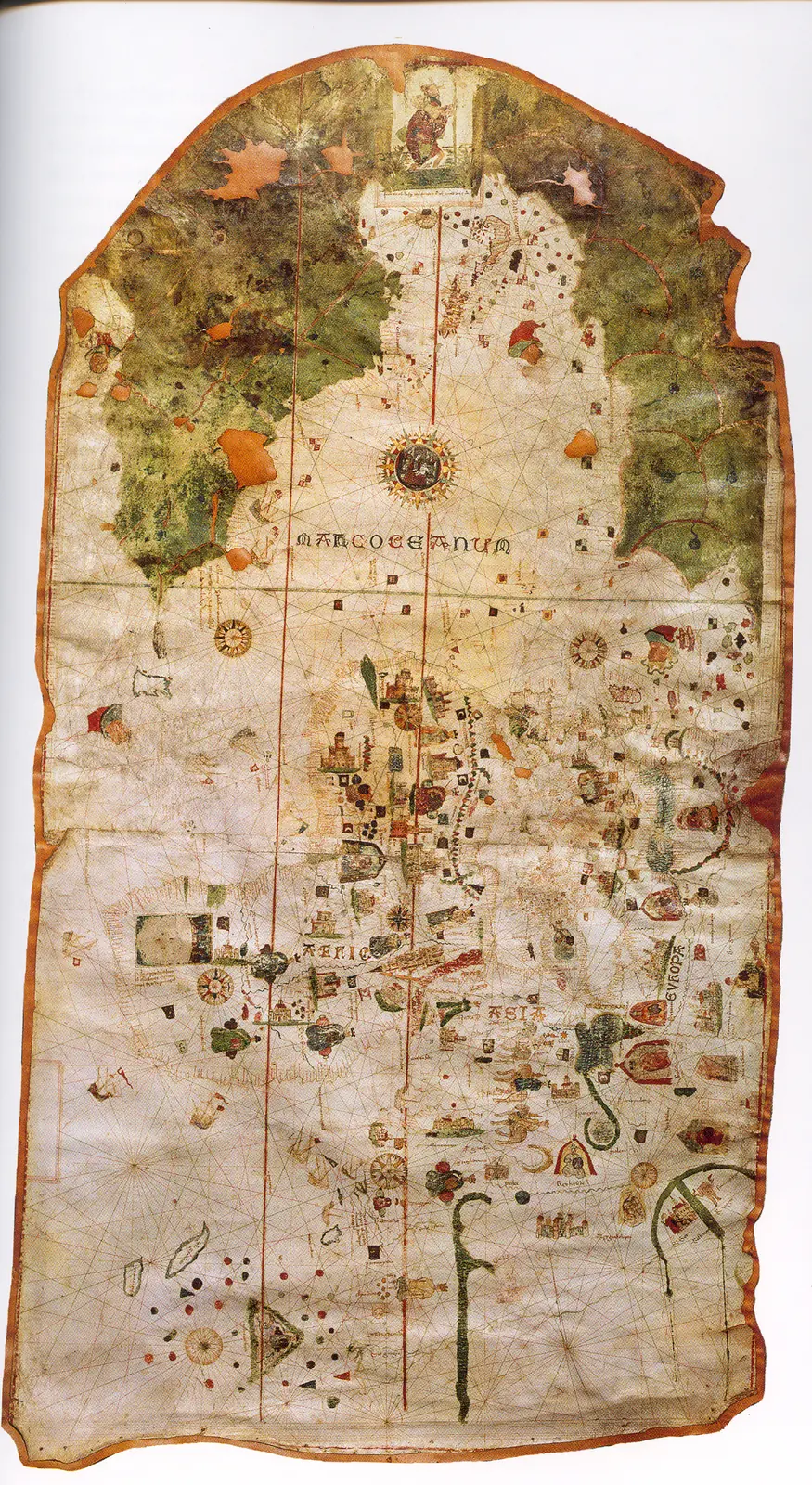
Juan de la Cosa's chart · 1500. It is not a map of the route of Columbus's first voyage. The image reproduces the chart preserved in the Naval Museum, MNM 257.
Caverio planisphere · Around 1505. The dating is approximate. It describes accumulated cartographic knowledge; it is not presented as a map carried aboard by Columbus or Ojeda.
Fragment of the Piri Reis world map · 1513. Only a fragment survives. The place names and coastal outlines require specialized reading; the image is not a complete description of the world.
Carta marina navigatoria · 1516. The images and texts combine nautical information and the author's interpretations. It does not record the voyage of Solís or Magellan.
Americae sive novi orbis, nova descriptio · 1570. The depictions of the far south and the interior territories contain incomplete information and hypotheses of the period.
Art and memory
- Portrait of Bartolomé Colón · 1889 (reproduced edition)
- Portrait of Hernando Colón · Seventeenth century
- Portrait of a Man, thought to be Christopher Columbus · Before 1519
Other expeditions with shared protagonists
- Reinforcement of Bartholomew Columbus on Hispaniola
- Establishment and founding of Santo Domingo (1496–1498)
- Columbus's fall as governor
- Columbus's return and the death of Isabella of Castile
Mentioned in other entries
Una mención permite investigar una relación; no implica participación en la expedición ni acredita por sí sola el pasaje citado.
Sources and references
- [B9] Select Letters of Christopher Columbus. Cristóbal Colón; edición de R. H. Major. Hakluyt Society edition (nineteenth century). Original record
- [B2] History of the Indies. Volume I. Bartolomé de las Casas. 16th-century text; Madrid edition, 1875; digitization, 2007. Original record
- [B1] General and Natural History of the Indies: second part, first volume. Gonzalo Fernández de Oviedo; edition by José Amador de los Ríos. Work of the 16th century; linked volume edited in 1852. Original record
- [B12] Historia del almirante don Cristóbal Colón. Hernando Colón. Mid-sixteenth-century work; Madrid edition. Original record
- [B14] Colección de los viages y descubrimientos, tomo II: Documentos de Colón y de las primeras poblaciones. Martín Fernández de Navarrete. Edition of 1859. Original record
- [B8] Cristóbal Colón, Diccionario Biográfico Español. Juan Pérez de Tudela y Bueso · Real Academia de la Historia. n.d.; edition date not established. Original record
- [B16] Historia de las Indias, volumen 3 de 5. Bartolomé de las Casas. Work written between 1527 and 1561; edition of 1875. Original record
- [B134] Hernando Colón. Luis Arranz Márquez. Undated electronic edition; consulted on 2 November 2026. Original record
- The Columbian voyages: synthesis and documents. Ministry of Culture / State Archives. Institutional synthesis; it distinguishes the four voyages and their dates.
- First expeditions toward Central America and Yucatán. UNAM, Institute of Legal Research / Anáhuac Veracruz University. Study with references to chronicles and to the itinerary of the chaplain Juan Díaz; useful for the campaigns of 1509–1510 and Grijalva's departure.
Documents and call numbers
- PATRONATO,295,N.9 / RES/175 · Columbus's letter to the Monarchs (Carta Rarísima)
General bibliography guides further reading; it is not a pinpoint reference for every claim. Page, chapter and archival references are identified at the relevant passages.
Further reading and comparison
- First Voyage of Columbus: Discovery of America · 1492
- Second Voyage of Columbus: Colonization of the Antilles · 1493
- Exploration of southern Cuba and Jamaica · 1494
- Expeditions on Hispaniola and the repartimiento system · 1495
- Return and outcome of Columbus's second voyage · 1496
- Third Voyage of Columbus: Discovery of the Mainland · 1498
Examine and compare documents
- Columbus’s four voyages: different documents — Did Columbus write every account of the four voyages? ·
Documentary supplements with their own review scope; they do not certify a complete collation of this entry.
Send comments to the author
Found an error or have information to contribute? Write privately to the author.