

Mendaña's First Expedition: Discovery of the Solomon Islands
In this entry · 18 sections
- Context
- Stages
- Events of this expedition
- Route data
- Outcome
- Limits of the evidence
- Expedition facts
- Organisation
- Objectives
- Encounters and societies
- Recorded vessels
- People and societies
- Related people
- Related cartography
- Art and memory
- Other expeditions with shared protagonists
- Sources and references
- Sources of the related expeditions
Expedition · 1567. Álvaro de Mendaña.
On 19 November 1567 two ships under Álvaro de Mendaña, a young man of about twenty-five, nephew of the governor, leave Callao, in Peru. With him goes the cosmographer Pedro Sarmiento de Gamboa. The government of Peru had gathered traditions about western lands, the wish to find resources and expectations of a southern land. Oceanic peoples had known and sailed those waters long before. [B72] [B155]
After almost three months’ crossing, in February 1568 they sight Santa Isabel, in the islands Mendaña will call Solomon. For months they visit the islands, among them Guadalcanal, with contacts, exchanges and clashes. Then they sail east and north, and in January 1569 reach the coast of Colima, in New Spain, before returning to Peru. [B155] [B72]
The campaign left news of the Solomons in European archives and maps. No permanent colony was established, and the problem of finding the islands again with precision was not even solved: almost thirty years would pass before Mendaña tried again. [B155] [B72]
Context
The projects of the government of Peru combined traditions about western lands, the search for resources and expectations of a southern land. The knowledge and navigation of the oceanic populations preceded European arrivals. [B72]
Stages
- November 1567, Callao: Departure; the naval source used places the departure on the 19th. [B72]
- 1568, South Pacific: Crossing and sightings before the archipelago. [B72]
- February 1568, Santa Isabel, Solomon Islands: Arrival at the archipelago and first survey base. [B72]
- 1568, Guadalcanal and other islands: Surveys, contacts and clashes. [B72]
- January 1569, Coast of Colima: After reaching Baja California, the ships arrived at the coast of Colima before continuing to Peru. [B72]
- 1569, Peru: Return of the enterprise to its area of departure. [B72]
Events of this expedition
Route data
- 2 ships, Los Reyes and Todos Santos, with about 150 men.
- Pedro Sarmiento de Gamboa and the pilot Hernán Gallego took part in the voyage.
- The name Solomon Islands evoked the riches of the biblical king.
Outcome
Olano Pastor’s account documents surveys in the Solomons and the return to America in 1569. [B72] [B72]
No permanent colony was established, and the problem of finding the islands again with precision was not solved. [B72]
Limits of the evidence
This campaign is distinguished from the 1595 voyage and the departure is corrected from 18 to 19 November 1567 according to the source indicated. [B72]
Equivalences between historical and modern names are the cited study’s reconstruction; they are not presented as coordinates recorded by the navigators. [B72]
Expedition facts
| Date | 1567 |
|---|---|
| Leader | Álvaro de Mendaña |
| Departure | Not specified in this entry |
| Destination | — |
| Period | 1567–1569 |
Organisation
Two ships left Callao in November 1567. The pilots' discussions about the course and distance covered show the difficulties of calculating longitude and relocating the archipelagos. [B72] [B72]
Objectives
- To locate lands and resources west of Peru [B72]
- To survey islands and possibilities of settlement [B72]
Encounters and societies
Contacts varied between exchanges and clashes; the demands for provisions and the violence damaged relations. The island populations did not necessarily share the aims or interpretations of the expedition members. [B72]
Recorded vessels
- Olano Pastor identifies the two naos as Los Reyes and Todos los Santos; the brigantine Santiago was built at Santa Isabel. [B72] [B72]
People and societies
- Álvaro de Mendaña: Expedition general [B72]
- Hernán Gallego: Chief pilot [B72]
- Pedro Sarmiento de Gamboa: Participant and author of an account [B72]
- Pedro de Ortega Valencia: Field marshal (maestre de campo) and head of reconnaissance [B72]
Related people
Related cartography
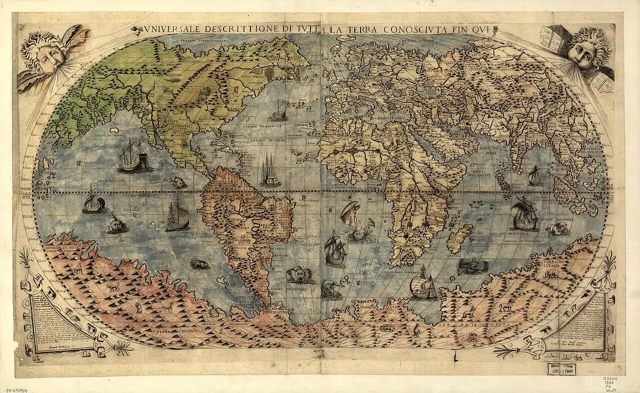
Universale descrittione di tutta la terra conosciuta fin qui · 1565. The continental shapes and the hypothetical southern land belong to the cartography of the time. The presence of a place does not prove a visit by the selected expedition.
Nova et aucta orbis terrae descriptio · 1569. The projection enlarges surfaces toward the poles. Distances should not be measured directly on the image nor its lines confused with routes actually sailed.
Asiae nova descriptio · Copy of 1579, based on the author's earlier cartography. The record dates the copy to 1579. Luzon does not appear and several geographic shapes are distorted: its usefulness is to compare the knowledge of the period.
Maris Pacifici · 1589. The ship Victoria recalls the circumnavigation, but does not make the map a layout of the route of 1519–1522. The date of the map must be distinguished from that of the voyage.
Indiae Orientalis, insularumque adiacentium typus · Copy of the Latin edition of 1603; plate first published in 1570. The image is of 1603, not of the first edition of 1570. It does not describe Urdaneta's tornaviaje nor Mendaña's complete routes.
Art and memory
- Portrait of Álvaro de Mendaña · Date not established
Other expeditions with shared protagonists
- Fleet of Flores de Valdés and Sarmiento to the Strait
- Mendaña's Second Expedition: Marquesas and Santa Cruz
Sources and references
- [B53] The practical conditions of Mendaña’s and Quirós’s voyages to Oceania. Annie Baert. Accessed 1 November 2026. Original record
- [B155] Mendaña and the Bay of the Star: return of 1568–1569. O. H. K. Spate. The Spanish Lake, a 20th-century study of 16th-century voyages. Original record
- [B25] Portuguese Cartography in the Renaissance. The History of Cartography, volume 3. Modern research on Renaissance cartography. Original record
- [B72] Álvaro de Mendaña y Neira, Diccionario Biográfico Español. Real Academia de la Historia. n.d.; edition date not established. Original record
- Solomon Islands: campaign of 1567–1569. Institute of Naval History and Culture; Cesáreo Fernández Duro, Armada española, volume II. Historical synthesis with documentary sources. The departure date it uses is 19 November 1567.
- Documents of Mendaña's expeditions and will of 1595. AGI / PARES. The file includes accounts of the first voyage, documentation of the 1595 fleet and the will made at Santa Cruz.
- Mendaña and the Bay of the Star: return of 1568–1569. Australian National University Press, The Spanish Lake, chapter 5. Historical study with references to the voyage: Baja California, the coast of Colima, later stopovers and arrival at Callao. The reference to Colima does not fix the exact anchorage.
General bibliography guides further reading; it is not a pinpoint reference for every claim. Page, chapter and archival references are identified at the relevant passages.
Sources of the related expeditions
- [B3] The Spanish Lake
- [B4] España y el Pacífico: un breve repaso a las expediciones españolas de los siglos XVI al XVIII
- [B6] Spanish discoveries in the South Sea
- [B7] Los hallazgos españoles en el Pacífico
- [B68] Documents of Mendaña's expeditions and will of 1595
- [B158] Solomon Islands: campaign of 1567–1569
Send comments to the author
Found an error or have information to contribute? Write privately to the author.