

The Nodals discover the Diego Ramírez Islands
In this entry · 5 sections
10 February 1619 · South of Cape Horn
It is 10 February 1619, at the southern tip of the American continent. Two small caravels, the Nuestra Señora de Atocha and the Santo Domingo, sail through hard winds and heavy seas south of the Le Maire Strait. On deck are the brothers Bartolomé and Gonzalo García de Nodal, captains of the expedition.
They left Lisbon months ago. The Crown had sent them to check disquieting news: Dutch sailors had found a new passage between the Atlantic and the Pacific, south of Tierra del Fuego, which endangered Spanish control of the Strait of Magellan.
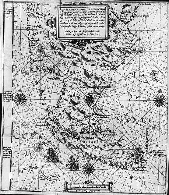
Bartolomé and Gonzalo García de Nodal, during their expedition to the southern tip of the Americas, discover the Diego Ramírez Islands, south of Cape Horn. They bear the name of the expedition’s cosmographer.
The two caravels sailed around Tierra del Fuego and returned without losing a single crew member.
The Spanish reconnaissance checks Dutch reports of the southern passage and adds observations of its own. Diego Ramírez’s work makes it possible to study how the cartography of the route was built; verifying an earlier route and recognising some islands are different actions within the same voyage. [B156]
The Nodal voyage closes the period covered by this atlas and confirms, with the information it brings back, that the southern end of America had more than one way to the Pacific.
Context
Expedition of the Nodal Brothers: Survey of the Strait of Magellan
Survey of the southern passages by the García de Nodal brothers and the pilot Diego Ramírez de Arellano, after the news of Le Maire and Schouten's voyage. [B112] [B139]
The monarchy wanted to know the passages south of Tierra del Fuego and assess their implications for navigation and the defense of the Pacific. The campaign had a specific cartographic and reconnaissance objective. [B139]
Why it matters
It broadens the hydrographic knowledge of Tierra del Fuego and of the routes between the Atlantic and the Pacific.
Where it appears
Expeditions and episodes
Maps
Art
Linked people
Sources for this milestone
- [B156] Study and rutter of the Nodal brothers
- [B112] Account of the voyage of Captains Bartholome Garcia de Nodal and Gonzalo de Nodal to the new Strait of San Vicente
- [B123] The maps and the first circumnavigation
- [B139] Cuatro siglos del viaje de los hermanos Nodal a la Tierra del Fuego (1618–1619)
- [B177] Bartolomé García de Nodal
- [B180] Diego Ramírez de Arellano
- [B181] Account of the voyage of the Nodal brothers, Madrid, 1621
- [B191] Filólogos en la mar: hacia una edición crítica digital de los manuscritos de Diego Ramírez de Arellano sobre los estrechos de Magallanes y Mayre
Send comments to the author
Found an error or have information to contribute? Write privately to the author.