

Saavedra's Expedition: Relief of the Moluccas
In this entry · 19 sections
- Context
- Stages
- Events of this expedition
- Route data
- Outcome
- Limits of the evidence
- Expedition facts
- Organisation
- Objectives
- Encounters and societies
- Ships and crew
- People and societies
- Related people
- Related cartography
- Other expeditions with shared protagonists
- Sources and references
- Further reading and comparison
- Examine and compare documents
- Sources of the related expeditions
Expedition · 1527. Álvaro de Saavedra.
The imperial order of 20 June 1526 instructed Cortés to seek news of Trinidad and the Loaísa and Cabot expeditions. The edited relation and diary date departure from Zihuatanejo to 1 November 1527; Cuesta Domingo gives 31 October. The edition lists three ships with 110 people distributed among them. [B57] [B157] [B57]
The diary describes a leak from the eighth day and the decision to continue. Cuesta places dispersal in December and Florida’s arrival at Tidore on 30 March 1528. There Saavedra assisted Hernando de la Torre and his men; his June departure was not an evacuation of all of them. [B157] [B57] [B57]
Cuesta distinguishes a return attempt in 1528, ending back in the Moluccas, and another in 1529 during which Saavedra died. This is not presented as a successful Pacific return. The 1565 returns and their participants are treated separately. [B57] [B27]¶ [B27]
Context
The lack of news and Loaísa's difficulties prompted a link from the Mexican coast, closer to the Pacific. The enterprise combined relief, provisioning, survey and an interest in spices. [B57]
Stages
- November 1, 1527, Zihuatanejo: The diary begins on 1 November; Cuesta Domingo gives 31 October. [B157] [B57]
- 1527–1528, Pacific: The ships separated; only the Florida reached the Moluccas. [B57]
- 1528, Moluccas: Meeting with the survivors of Loaísa's fleet. [B57]
- 1528, Western Pacific: First attempt to return to New Spain, without success. [B57]
- 1529, Western Pacific: New attempt to return; death of Saavedra. [B57]
- After 1529, Moluccas: The survivors remained subject to negotiations and to Portuguese competition. [B57]
Events of this expedition
Route data
- Florida, flagship, with 12 sailors and 38 men-at-arms; Santiago, 45; Espíritu Santo, 15.
- First fleet to cross the Pacific from America, sent by Cortés.
- Contrary winds prevented the tornaviaje; Saavedra proposed cutting a canal through the isthmus.
Outcome
The feasibility of the crossing from America to the Moluccas was confirmed. [B57]
A regular return across the Pacific was not achieved; the Florida did not return to Mexico with the survivors, as the earlier account claimed. [B57]
Limits of the evidence
The diary date and the biographical reconstruction differ by one day; neither supports the former 1 January placeholder. [B157] [B57]
Saavedra’s failed attempts are distinguished from the 1565 returns of Arellano and Lope Martín and of Salcedo and Urdaneta. [B57] [B27]¶ [B27]
Expedition facts
| Date | 1527 |
|---|---|
| Leader | Álvaro de Saavedra |
| Departure | Not specified in this entry |
| Destination | — |
| Period | 1527–1529; survivors with later returns |
Organisation
The edited relation and diary give 1 November 1527 and list 50 people in Florida, 45 in Santiago and 15 in Espíritu Santo. Cuesta Domingo dates departure to 31 October. The two dates are presented separately. [B157] [B57]
Objectives
- To bring relief and information to the Moluccas [B57]
- To explore a link between New Spain and Asia [B57]
- To attempt the return toward America [B57]
Encounters and societies
Cuesta Domingo describes provisioning the Spaniards at Tidore, relations with local authorities and conflict with Portuguese forces at Ternate. [B57]
Ships and crew
| Ship | Captain | Master | Pilot | Reference |
|---|---|---|---|---|
| Florida | Álvaro de Saavedra | Not documented here | Not documented here | Saavedra's logbook: documentary edition of the CEDCS, p. 20 [B157] |
| Santiago | Luis de Cárdenas | Not documented here | Not documented here | Saavedra's logbook: documentary edition of the CEDCS, p. 20 [B157] |
| Espíritu Santo | Pedro de Fuentes | Not documented here | Not documented here | Saavedra's logbook: documentary edition of the CEDCS, p. 20 [B157] |
People and societies
- Álvaro de Saavedra Cerón: Captain of the expedition [B157]
- Luis de Cárdenas: Captain of the Santiago, according to the documentary edition [B157]
- Pedro de Fuentes: Captain of Espíritu Santo in the documentary edition; Cuesta Domingo calls him patrón [B157] [B57]
- Hernando de la Torre: In charge of the survivors with whom Saavedra met [B57]
Related people
Related cartography
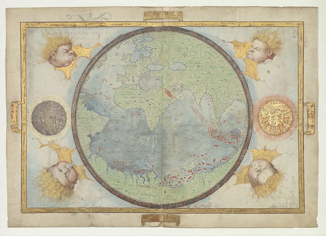
Miller Atlas: world map · 1519. The world map is shown, not all the atlas's sheets. Its composition and decoration also express a political vision of Portuguese dominion.
Universal chart of Diego Ribero: reproduction · Model of 1529; 2019 reproduction based on a 19th-century facsimile. The linked copy is a 2019 reproduction, not the original of 1529. The chain of reproduction is expressly kept.
Universale descrittione di tutta la terra conosciuta fin qui · 1565. The continental shapes and the hypothetical southern land belong to the cartography of the time. The presence of a place does not prove a visit by the selected expedition.
Nova et aucta orbis terrae descriptio · 1569. The projection enlarges surfaces toward the poles. Distances should not be measured directly on the image nor its lines confused with routes actually sailed.
Asiae nova descriptio · Copy of 1579, based on the author's earlier cartography. The record dates the copy to 1579. Luzon does not appear and several geographic shapes are distorted: its usefulness is to compare the knowledge of the period.
Maris Pacifici · 1589. The ship Victoria recalls the circumnavigation, but does not make the map a layout of the route of 1519–1522. The date of the map must be distinguished from that of the voyage.
Indiae Orientalis, insularumque adiacentium typus · Copy of the Latin edition of 1603; plate first published in 1570. The image is of 1603, not of the first edition of 1570. It does not describe Urdaneta's tornaviaje nor Mendaña's complete routes.
Other expeditions with shared protagonists
Sources and references
- [B3] The Spanish Lake. O. H. K. Spate. 1979; digital edition, 2004. Original record
- [B32] Caminos sobre la mar. Las expediciones a las islas de la especiería después de Magallanes, 1525–1564. Luis Alonso Álvarez. 2022. Original record
- [B62] Nautical treatises and documents of Magellan and Elcano. Naval Museum / Institute of Naval History and Culture. Contemporary catalog; works by Medina, Cortés and other 16th-century authors. Original record
- [B55] Colección de los viages y descubrimientos: Expediciones al Maluco. Viages de Loaisa y de Saavedra. Martín Fernández de Navarrete. Edition of 1837. Original record
- [B26] The Discovery and Conquest of the Molucco and Philippine Islands. Bartolomé Leonardo de Argensola. Work of 1609; English translation of 1708. Original record
- [B57] Álvaro Saavedra Cerón. Mariano Cuesta Domingo. Undated electronic edition; consulted on 2 November 2026. Original record
- [B157] Account of the voyage of Captain Álvaro de Saavedra Cerón to the Moluccas. Vicencio de Nápoles; edition and presentation by María Luisa Rodríguez-Sala. Voyage of 1527–1529; account by Vicencio de Nápoles, 1534; edition of 2017. Original record
- [B27] History of the Philippine Islands. Antonio de Morga. Work of 1609; English translation. Original record
- Álvaro de Saavedra's logbook and documentation of the fleet. CEDCS, Archivo de la Frontera; edition by María Luisa Rodríguez-Sala. Documentary edition: the logbook begins the voyage on 1 November 1527 and describes the three ships.
- The tornaviaje and Saavedra's attempts to return. Ministry of Defense, Revista Ejército 924. Synthesis of Pacific voyages and the problem of returning toward America.
General bibliography guides further reading; it is not a pinpoint reference for every claim. Page, chapter and archival references are identified at the relevant passages.
Further reading and comparison
- Francisco de Montejo's First Expedition to Yucatán · 1527
- Pánfilo de Narváez's Expedition to Florida · 1527
- Diego García de Moguer's Expedition · 1527
Examine and compare documents
- New Guinea and the San Jerónimo: accounts and service records — What does each account contribute, and how does it differ from the study interpreting it? ·
- The eastward return: failed attempts and two returns in 1565 — Why are reaching Asia from America and finding a return route different problems? ·
Documentary supplements with their own review scope; they do not certify a complete collation of this entry.
Send comments to the author
Found an error or have information to contribute? Write privately to the author.