

Urdaneta's discovery of the return route (tornaviaje)
In this entry · 19 sections
- Context
- Stages
- Events of this expedition
- Route data
- Outcome
- Limits of the evidence
- Expedition facts
- Organisation
- Objectives
- Encounters and societies
- Ships and crew
- People and societies
- Related people
- Related cartography
- Art and memory
- Other expeditions with shared protagonists
- Sources and references
- Further reading and comparison
- Sources of the related expeditions
Episode · 1565. Andres de Urdaneta.
On 1 June 1565 the ship San Pedro leaves Cebu bound for New Spain. The problem was known: since Magellan the Spaniards knew how to go to Asia across the Pacific with the winds behind them, but returning against them was another matter. Several attempts, among them Saavedra’s, had failed. Legazpi’s campaign started from that accumulated experience. [B52] [B105]
Urdaneta, an Augustinian friar who had survived the Loaísa expedition, designs a route across the North Pacific: go up to high latitudes, near 40° north, to find westerly winds, and then come down toward the American coast. The crossing lasts more than four months, amid sickness and deaths. In October the ship reaches the coast of New Spain and continues to Acapulco. [B100] [B105]
The tornaviaje made possible the connection that would sustain trans-Pacific trade. The organisation of the Manila galleon was a later development, not a fully constituted institution when leaving Cebu. [B105]
Arellano and Lope Martín’s San Lucas had returned earlier. Morga records that precedence but expresses an adverse judgment that must not be confused with the fact of the return. [B27]
The log extract reproduced by Sierra dates passing Navidad to 1 October and arrival at Acapulco to the 8th. The study’s statement on the following page giving the 1st for Acapulco does not match that extract; the discrepancy is retained. [B100]
Context
The main difficulty was not just crossing to Asia but returning east. Winds and currents forced a search for latitudes different from the outbound route. The campaign built on accumulated experience and earlier attempts, including Saavedra's. [B105] [B105]
Stages
- June 1, 1565, Cebú: Departure of the return commission. [B52]
- 1565, North Pacific: Cuesta describes reaching latitudes near 40° N and seeking eastward winds; no single longitude is assigned to the entire crossing. [B105]
- October 1565, Coast of New Spain: Landfall and coastal navigation toward Acapulco. [B105]
- October 1, 1565, Off the port of Navidad: The rutter places the ship off Navidad before continuing toward Acapulco. [B100]
- October 1565, Acapulco: Arrival and delivery of news of the Philippine settlement. [B100] [B27]
Events of this expedition
Route data
- The San Pedro climbed to near 40° N to catch the westerlies.
- About 130 days of sailing; several crew members died of scurvy.
- The route served the Manila galleon for 250 years.
Outcome
The tornaviaje made possible the connection that would sustain trans-Pacific trade. [B105]
Cuesta’s biography relates this return to the later Manila galleon route; the 1565 crossing is distinguished from its commercial development. [B105]
Limits of the evidence
Alonso de Arellano's return in 1565 must be distinguished from the route, documentation and continuity associated with Urdaneta. [B27]¶ [B100]
The map's line is a schematic and not a day-by-day reconstruction of the ship's position.
Expedition facts
| Date | 1565 |
|---|---|
| Leader | Andres de Urdaneta |
| Departure | Not specified in this entry |
| Destination | — |
| Period | 1565 |
Organisation
The San Pedro left Cebu on 1 June 1565. Felipe de Salcedo held command of the ship and Urdaneta played a decisive role in the navigation; government of the fleet and piloting are not confused. [B52] [B52]
Objectives
- To return to New Spain to report and request support [B27]
- To identify a repeatable return route from the Philippines [B105]
Encounters and societies
Cuesta describes illness and crew exhaustion. The extract reproduced by Sierra counts sixteen dead and eighteen men able to work when passing Navidad. [B105] [B100]
Ships and crew
| Ship | Captain | Master | Pilot | Reference |
|---|---|---|---|---|
| San Pedro | Felipe de Salcedo | Martín de Ibarra | Esteban Rodríguez and Rodrigo de Espinosa | Spanish Geographical Society: composition of the San Pedro on the tornaviaje of 1565 [B165] |
San Pedro: Andrés de Urdaneta directed the navigation as cosmographer. Ibarra and Esteban Rodríguez died before the arrival at Acapulco; these posts are not confused with those of the outbound voyage of 1564.
People and societies
- Andrés de Urdaneta: Main person responsible for the navigation of the return [B105]
- Felipe de Salcedo: Captain of the San Pedro [B52]
- Miguel López de Legazpi: Stayed in the Philippines when sending the return commission [B52]
Related people
Related cartography
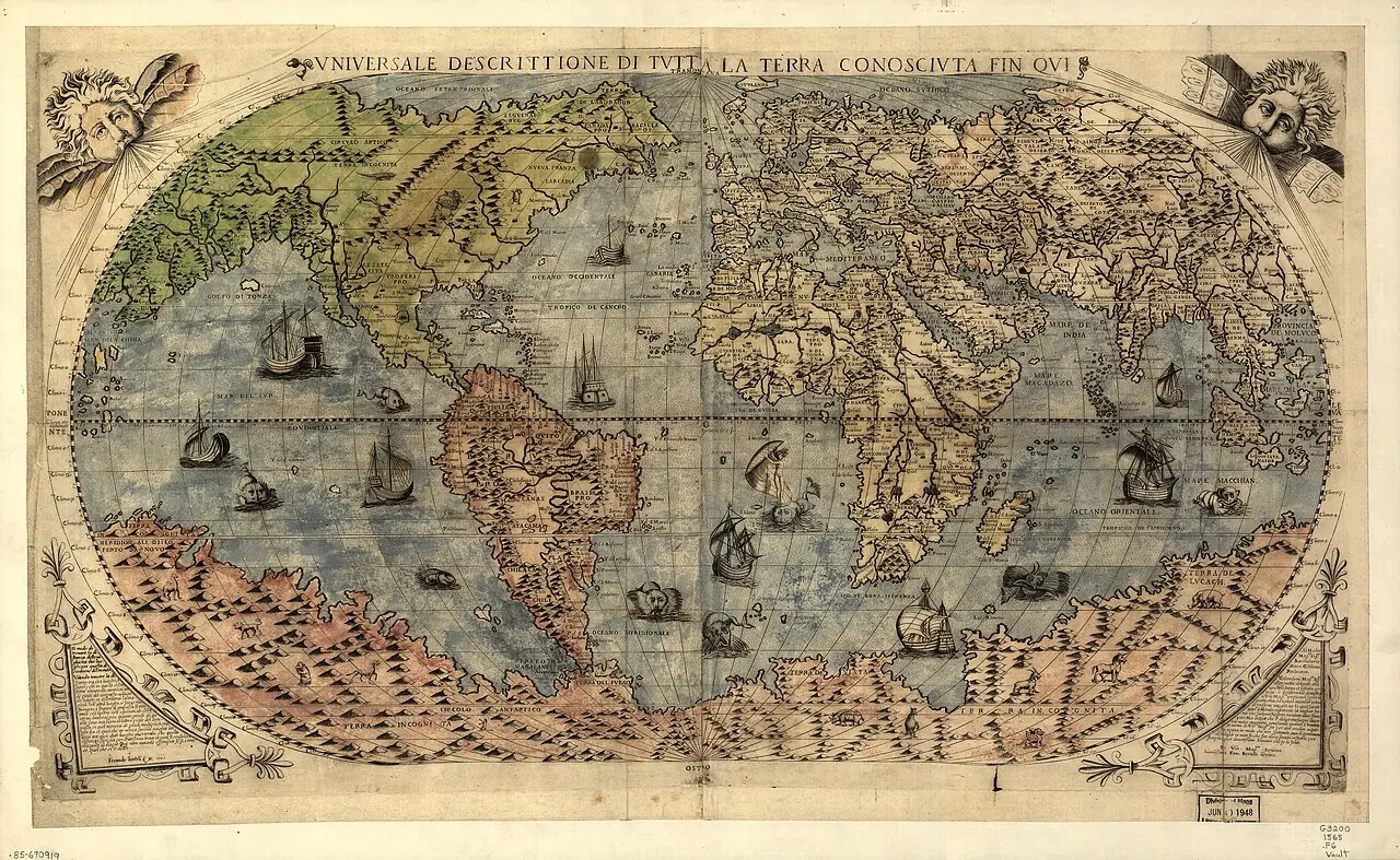
Universale descrittione di tutta la terra conosciuta fin qui · 1565. The continental shapes and the hypothetical southern land belong to the cartography of the time. The presence of a place does not prove a visit by the selected expedition.
Asiae nova descriptio · Copy of 1579, based on the author's earlier cartography. The record dates the copy to 1579. Luzon does not appear and several geographic shapes are distorted: its usefulness is to compare the knowledge of the period.
Maris Pacifici · 1589. The ship Victoria recalls the circumnavigation, but does not make the map a layout of the route of 1519–1522. The date of the map must be distinguished from that of the voyage.
Indiae Orientalis, insularumque adiacentium typus · Copy of the Latin edition of 1603; plate first published in 1570. The image is of 1603, not of the first edition of 1570. It does not describe Urdaneta's tornaviaje nor Mendaña's complete routes.
Art and memory
- Portrait of Andrés de Urdaneta · Date not established
Other expeditions with shared protagonists
Sources and references
- [B27] History of the Philippine Islands. Antonio de Morga. Work of 1609; English translation. Original record
- [B100] The expedition of Legazpi and Urdaneta: the tornaviaje. Blas Sierra de la Calle. Study published in 2009 on the tornaviaje of 1565. Original record
- [B54] Events in the Philippine Islands. Antonio de Morga. Mexico: Jerónimo Balli and Cornelio Adriano César, 1609. Original record
- [B26] The Discovery and Conquest of the Molucco and Philippine Islands. Bartolomé Leonardo de Argensola. Work of 1609; English translation of 1708. Original record
- [B52] Miguel López de Legazpi. Leoncio Cabrero Fernández. Undated electronic edition; consulted on 2 November 2026. Original record
- [B105] Andrés de Urdaneta y Ceraín, Diccionario Biográfico Español. Mariano Cuesta Domingo · Real Academia de la Historia. n.d.; edition date not established. Original record
- [B165] The Philippines: Legazpi (1564–65). Francisco Mellén Blanco. Historical article; date not specified in the body consulted. Original record
- Legazpi and Urdaneta: organization of the expedition and tornaviaje. Institute of Naval History and Culture, Notebook 58. Studies on naval organization and navigation. The outbound voyage began in November 1564 and Urdaneta's return was made in 1565.
- The tornaviaje and Saavedra's attempts to return. Ministry of Defense, Revista Ejército 924. Synthesis of Pacific voyages and the problem of returning toward America.
- The expedition of Legazpi and Urdaneta: the tornaviaje. Institute of Naval History and Culture, Notebook 58. It includes the passage of the rutter placing the ship off Navidad on 1 October and its arrival at Acapulco on 8 October 1565; it does not prove a landing at Navidad.
Documents and call numbers
- PATRONATO,37,R.36 · Urdaneta's account of the tornaviaje
General bibliography guides further reading; it is not a pinpoint reference for every claim. Page, chapter and archival references are identified at the relevant passages.
Send comments to the author
Found an error or have information to contribute? Write privately to the author.