

Mendoza's Expedition: First Founding of Buenos Aires
In this entry · 19 sections
- Context
- Stages
- Events of this expedition
- Route data
- Outcome
- Limits of the evidence
- Expedition facts
- Organisation
- Objectives
- Encounters and societies
- Recorded vessels
- People and societies
- Related people
- Related cartography
- Art and memory
- Mentioned in other entries
- Sources and references
- Further reading and comparison
- Sources of the related expeditions
Expedition · 1535. Pedro de Mendoza.
The Toledo capitulations of 21 May 1534 placed an exploration, conquest and settlement venture under Mendoza. Rodríguez de la Torre dates departure to 24 August 1535: thirteen ships, three more joining at the Canaries, and between 1,500 and 2,000 people. No single total is imposed on every phase. [B117] [B117]
The Mendoza study proposes 3 February 1536 for Buenos Aires; the Schmidl study gives the 2nd. Espínola describes initial Querandí provisioning, the Spanish attack led by Diego de Mendoza and subsequent hunger. Ayolas’s explorations and the forts belong to this crisis. [B117] [B118]
Mendoza began his return on 22 April 1537 and died on 23 June, beyond Cape Verde according to Rodríguez de la Torre. His successors remained in the basin. Destruction of the first Buenos Aires settlement in 1541 is distinguished from Garay’s 1580 foundation. [B117] [B107]
Context
Rodríguez de la Torre relates the venture to expectations of the Sierra de la Plata, Portuguese competition and the 1534 capitulations. Espínola describes the Querandí as initial food suppliers and their resistance to the later attack led by Diego de Mendoza. [B117] [B118]
Stages
- August 1535, Sanlúcar: Departure of the fleet. [B117]
- 1535–1536, Brazilian coast: Stopovers during the South American crossing. [B117]
- February 1536, River Plate: Installation of the first settlement of Buenos Aires. [B117]
- 1536–1537, Inland rivers: Ayolas explored the Paraná and established Corpus Christi; Mendoza founded Buena Esperanza and sent further expeditions inland. [B117]
- 1537, Return voyage: Mendoza died in the Atlantic before reaching Spain. [B117]
- 1541, Buenos Aires and Asunción: The Buenos Aires settlement was destroyed in 1541. Asunción, where Salazar had established a fortified house in 1537, belongs to the continuation after Mendoza’s death. [B117] [B107]
Events of this expedition
Route data
- About 12 ships and about 1,500 men, one of the largest fleets of the century.
- The settlement of Buenos Aires suffered hunger and the siege by the Querandí and other peoples.
- Ulrich Schmidl, a Bavarian soldier, left the chronicle of the enterprise.
Outcome
The 1536 settlement had no direct urban continuity until 1580. [B117]
The continuation is associated with Salazar, Ayolas and Irala. Garay’s 1580 foundation is distinguished from Mendoza’s settlement. [B117] [B116]
Limits of the evidence
Rodríguez de la Torre proposes 3 February; Espínola, following Schmidl, gives the 2nd. February 1536 is retained without erasing the difference of day. [B117] [B118]
The map marks the present-day city as a geographic reference, not the exact archaeological site of Mendoza's settlement.
Expedition facts
| Date | 1535 |
|---|---|
| Leader | Pedro de Mendoza |
| Departure | Sanlúcar de Barrameda |
| Destination | — |
| Period | 1535–1537; the first settlement of Buenos Aires was abandoned in 1541 |
Organisation
The fleet left Sanlúcar in August 1535. Sources differ on the count of ships and people; soldiers, sailors, settlers and women traveled. The whole campaign is not equated with the founding act of a modern city. [B117]
Objectives
- To establish a Castilian presence on the Río de la Plata [B117]
- To seek communication with interior territories and wealth [B117]
- To found settlements and exercise the governorship granted [B117]
Encounters and societies
The demands for food and the occupation of the territory altered relations with the Querandí and other peoples. The colonial chroniclers describe an extreme crisis, but its episodes and figures require critical reading. [B118]
Recorded vessels
- Fleet of more than ten vessels; historical counts are not uniform [B117]
People and societies
- Pedro de Mendoza: Adelantado and head of the enterprise [B117]
- Juan de Ayolas: Led expeditions into the interior [B117]
- Domingo Martínez de Irala: Prominent figure in colonial continuity [B116]
- Ulrico Schmidel: Participant and author of a later account [B118]
- Querandí communities and other peoples of the estuary: Interlocutors and resisters of the occupation [B118]
Related people
Related cartography
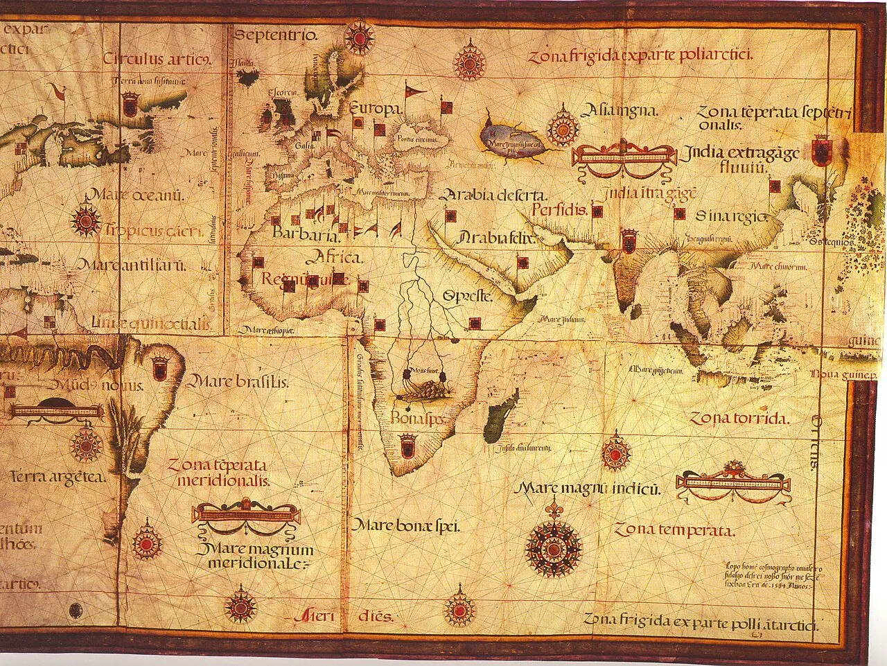
Nautical planisphere of Lopo Homem · Original of 1554; the museum displays a facsimile. The Galileo Museum distinguishes the original from the facsimile displayed. The record allows consultation of the work; no license is attributed here to its photographs.
Americae sive quartae orbis partis nova et exactissima descriptio · 1562. The copy in the image is reproduced from Wikimedia Commons; the institutional record allows comparison with another copy of the same work. It is not a reconstruction of all the routes.
La descrittione di tutto il Peru · 1565. The historical use of Peru in the title does not coincide with present-day borders. It is not a map drawn by Pizarro or Orellana.
Americae sive novi orbis, nova descriptio · 1570. The depictions of the far south and the interior territories contain incomplete information and hypotheses of the period.
Descriptionis Ptolemaicae augmentum: set of plates · Atlas of 1597; record of a 1964 facsimile; montage of reproductions with no precise date. The linked record describes a 1964 facsimile with an introduction by R. A. Skelton. The image is a montage of plates, not a single historical sheet. To cite a specific region its plate and edition must be located.
Art and memory
- Portrait of Domingo Martínez de Irala · Sixteenth century (record dating)
- Portrait of Juan de Ayolas · Circa 1856
- Portrait of Ulrico Schmidel · 1599 (engraving design; later reproduction)
- Americae sive quartae orbis partis nova et exactissima descriptio · 1562
Mentioned in other entries
Una mención permite investigar una relación; no implica participación en la expedición ni acredita por sí sola el pasaje citado.
Sources and references
- [B73] The Conquest of the River Plate (1535–1555). Ulrico Schmidl y Álvar Núñez Cabeza de Vaca; edición de Luis L. Domínguez. Hakluyt Society edition (1891). Original record
- [B130] Evidencias de arquitectura de materiales perecederos en Buenos Aires, Argentina (siglos XVI–XVIII). Daniel Schávelzon. 13 (2016), e041. Original record
- [B97] Ulrich Schmidl's Voyage to the Río de la Plata in Samuel Lafone Quevedo's translation (1903). Icíar Alonso Araguás. 2013 study of the 1903 translation of a 16th-century account. Original record
- [B117] Pedro de Mendoza y Luján. Fernando Rodríguez de la Torre. Undated electronic edition; consulted on 2 November 2026. Original record
- [B118] Ulrich Schmidl. Julio Espínola. Undated electronic edition; consulted on 2 November 2026. Original record
- [B107] Juan de Salazar de Espinoza. Olinda Massare de Kostianovsky. Undated electronic edition; consulted on 2 November 2026. Original record
- [B116] Domingo Martínez de Irala. Roberto Quevedo y Julio Espínola. Undated electronic edition; consulted on 2 November 2026. Original record
- The first Buenos Aires and its abandonment. Gobierno de la Ciudad de Buenos Aires. It places the first settlement in February 1536 and distinguishes its abandonment from Garay's founding of 1580.
- The first Buenos Aires and archaeology. Gobierno de la Ciudad de Buenos Aires. It discusses the character and location of Mendoza's settlement; reconstructions are not equivalent to an original plan.
Documents and call numbers
- PATRONATO,93A · Capitulation with Mendoza for the Río de la Plata
General bibliography guides further reading; it is not a pinpoint reference for every claim. Page, chapter and archival references are identified at the relevant passages.
Send comments to the author
Found an error or have information to contribute? Write privately to the author.