

La descrittione di tutto il Peru
In this entry · 8 sections
1565 · Paolo Forlani · Bibliothèque nationale de France / Gallica
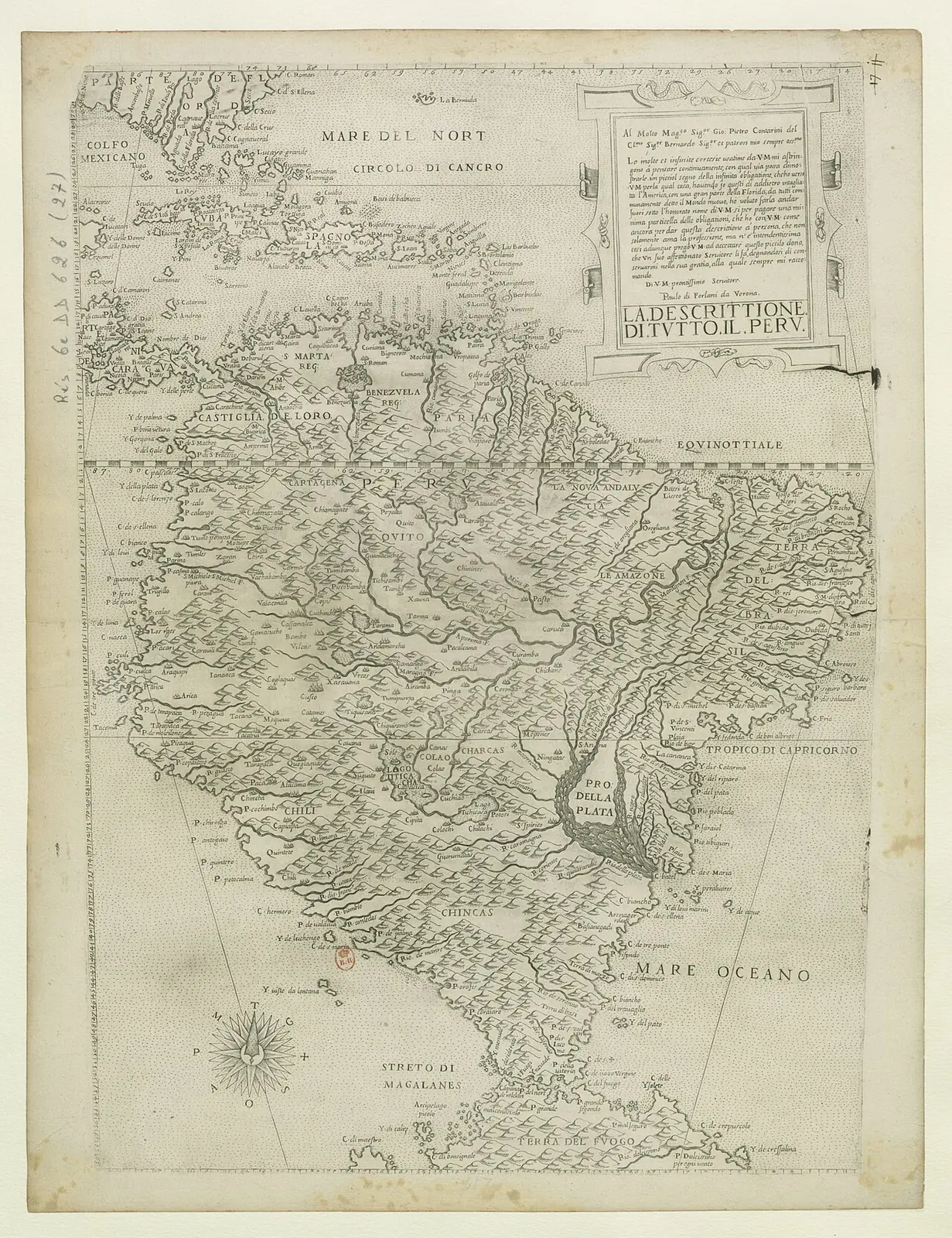
Italian representation of South America that broadens the comparison of the coasts and territories called Peru.
How to interpret the map
The historical use of Peru in the title does not coincide with present-day borders. It is not a map drawn by Pizarro or Orellana.
Provenance and rights
Paolo Forlani. Bibliothèque nationale de France / Gallica. Provenance of the reproduction indicated in its link.
Institutional record · Public domain

Related expeditions
- Mendoza's Expedition: First Founding of Buenos Aires
- Orellana's Second Expedition: Nueva Andalucía
- Start of the conquest of Peru
- Entry of Gonzalo Pizarro and Orellana's Descent (1541–1542)
Related protagonists
- Francisco de Orellana
- Francisco Pizarro
- Pedro de Mendoza
- Ana de Ayala
- Diego de Almagro
- Domingo Martínez de Irala
- Francisco de Xerez
- Gaspar de Carvajal
Maps
- Nautical planisphere of Lopo Homem
- Americae sive quartae orbis partis nova et exactissima descriptio
- Americae sive novi orbis, nova descriptio
- Descriptionis Ptolemaicae augmentum: set of plates
Art
- Portrait of Diego de Almagro
- Portrait of Domingo Martínez de Irala
- Portrait of Francisco de Orellana
- Portrait of Francisco Pizarro
- Portrait of Juan de Ayolas
- Portrait of Ulrico Schmidel
- La Descrittione di tutto il Peru
- Americae sive quartae orbis partis nova et exactissima descriptio
Show all links (9)
Related milestones
- Pizarro captures Atahualpa
- First establishment of Buenos Aires
- Foundation of Nuestra Señora de la Asunción
- Orellana completes the Amazon crossing
- Second founding of Buenos Aires
Sources of the related expeditions
- [B1] General and Natural History of the Indies: second part, first volume
- [B17] Francisco Pizarro González, Diccionario Biográfico Español
- [B31] History of the Conquest of Peru
- [B34] New Chronicle and Good Government
- [B59] The descendants of licenciado Gaspar de Espinosa
- [B60] Origins of the San Juan governorship: Gaspar de Espinosa
- [B63] True Account of the Conquest of Peru
- [B66] Francisco de Orellana
Show all links (28)
- [B73] The Conquest of the River Plate (1535–1555)
- [B74] Narrative of the Incas (Suma y narración de los Incas)
- [B76] Gonzalo Pizarro Viedma
- [B80] Francisco de Orellana: biography and two expeditions
- [B88] Reports on the Discovery of Peru
- [B91] Relation of the Discovery and Conquest of the Kingdoms of Peru
- [B97] Ulrich Schmidl's Voyage to the Río de la Plata in Samuel Lafone Quevedo's translation (1903)
- [B99] Capitulation for the conquest and settlement of Peru, Toledo, 26 July 1529
- [B102] Juan de Salazar de Espinoza. Journey to the Río de la Plata
- [B107] Juan de Salazar de Espinoza
- [B109] History of Espinosa de los Monteros: notable people
- [B110] Royal Commentaries of the Incas. Volume one
- [B116] Domingo Martínez de Irala
- [B117] Pedro de Mendoza y Luján
- [B118] Ulrich Schmidl
- [B120] The first Buenos Aires and archaeology
- [B130] Evidencias de arquitectura de materiales perecederos en Buenos Aires, Argentina (siglos XVI–XVIII)
- [B132] Francisco de Orellana, 1541–1542 and the later expedition
- [B135] Francisco López de Jerez
- [B136] The Travels of Pedro de Cieza de León, parte 2
Send comments to the author
Found an error or have information to contribute? Write privately to the author.